

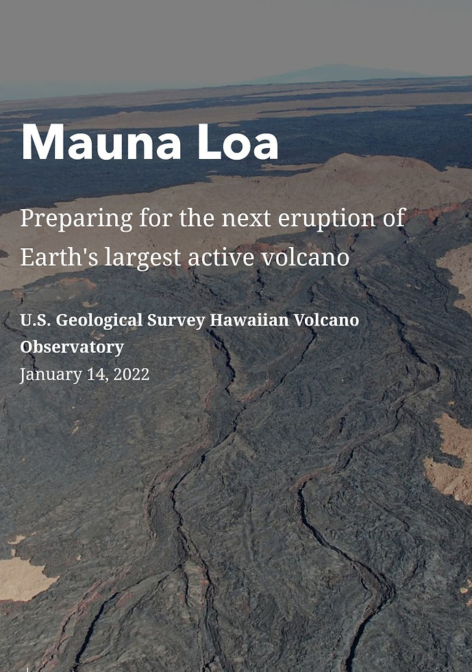
The world's largest active volcano , which takes up 51% of my beautiful Home, is prepping to blow.
- jasminessteiner
- Nov 2, 2022
- 7 min read
and mind you, we already have Kilauea erupting since sept 29, 2021. Needless to say, this causes alot who live in disaster prone areas to constantly be on alert . Here's a look into our daily updates:
MAUNA LOA VOLCANO 🌋 ⚠️💛💃
USGS UPDATE 11/3/22
(VNUM #332020)
19°28'30" N 155°36'29" W, Summit Elevation 13681 ft (4170 m)
Current Volcano Alert Level: ADVISORY
Current Aviation Color Code: YELLOW
Activity Summary: Mauna Loa is not erupting and there are no signs of an imminent eruption at this time. Monitoring data show no significant changes within the past 24 hours. Mauna Loa continues to be in a state of heightened unrest as indicated by increased earthquake activity and inflation of the summit. The current unrest is most likely being driven by renewed input of magma 2–5 miles (3–8 km) beneath Mauna Loa’s summit.
Observations: During the past 24 hours, HVO detected 13 small-magnitude (below M3.0) earthquakes 2–3 miles (2–5 km) below Mokuʻāweoweo caldera and 4–5 miles (6–8 km) beneath the upper-elevation northwest flank of Mauna Loa. Both of these regions have historically been seismically active during periods of unrest on Mauna Loa.
Global Positioning System (GPS) instruments at the summit and on the flanks of Mauna Loa continue to measure inflation at rates elevated since mid-September. However, tiltmeters at the summit are not showing significant surface deformation over the past week.
Concentrations of sulfur dioxide (SO2), hydrogen sulfide (H2S), and carbon dioxide (CO2), as well as fumarole temperatures, remain stable at the summit and at Sulphur Cone on the upper Southwest Rift Zone. Webcam and thermal camera views have shown no changes to the volcanic landscape on Mauna Loa over the past week.
Narrative: Heightened unrest began in mid-September 2022 with increased earthquake rates below Mauna Loa summit (from 10–20 per day to 40–50 per day), an increased rate of inflation recorded by GPS stations, and inflation recorded on the MOK tiltmeter. The unrest is likely caused by renewed input of magma into Mauna Loa’s summit reservoir system. As the reservoir expands it is triggering small earthquakes directly beneath Mokuʻāweoweo caldera and in a region just to the northwest of the caldera. Deeper magma input (greater than 2 miles, 3 kilometers) is detected by the continued increase in upward movement and extension measured between GPS stations located on the ground surface. Shallower magma input (less than 2 miles, 3 kilometers) was likely responsible for inflation recorded on the summit tiltmeter during the last two weeks of September. Current locations of earthquakes and deformation do not necessarily indicate the location of future eruptive activity.
Mauna Loa remains at an elevated alert level of ADVISORY/YELLOW. The current increase in activity does not suggest that a progression to an eruption is certain, and there are no indications that an eruption is imminent.
HVO will continue to closely monitor Mauna Loa for changes.
HVO will continue to issue daily Mauna Loa Volcano updates until further notice. Additional messages will be issued as needed.
For more information on current monitoring of Mauna Loa volcano, see: https://www.usgs.gov/volcanoes/mauna-loa/monitoring.
Related Volcano Watch from October 6, 2022: https://www.usgs.gov/observatories/hvo/news/volcano-watch-recent-events-mauna-loa-remind-us-be-prepared-quick-changes
Hawaiʻi Volcanoes National Park: https://www.nps.gov/havo/
County of Hawaiʻi Civil Defense Agency: https://hawaii-county-civil-defense-agency-hawaiicountygis.hub.arcgis.com/
Background:
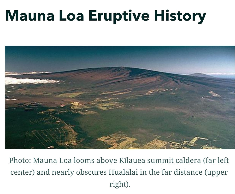
Mauna Loa is the largest active volcano on our planet and covers half of the Island of Hawaiʻi. Eruptions tend to produce voluminous, fast-moving lava flows that can impact communities on the east and west sides of the Island.
Mauna Loa eruptions typically start at the summit and, within minutes to months of eruption onset, can migrate into either the Northeast or Southwest Rift Zone, or radial vents on the north flank. Since its first well-documented eruption in 1843, the volcano has erupted 33 times with intervals between eruptions ranging from months to decades. Mauna Loa last erupted in 1984.
More Information:
Mauna Loa activity summary also available by phone: (808) 967-8866
Mauna Loa webcam images: https://www.usgs.gov/volcanoes/mauna-loa/webcams
Mauna Loa photos/video: https://www.usgs.gov/volcanoes/mauna-loa/photo-and-video-chronology-mauna-loa
Mauna Loa maps: https://www.usgs.gov/volcanoes/mauna-loa/maps
Mauna Loa FAQs: https://www.usgs.gov/volcanoes/mauna-loa/faqs
Recent Volcano Watch on Mauna Loa: https://www.usgs.gov/observatories/hvo/news/volcano-watch-failing-prepare-you-are-preparing-fail-benjamin-franklin
Map-based webpage for Mauna Loa: https://geonarrative.usgs.gov/maunaloa/

Previous mauna loa flows shown in image above. Where we live , on the east side --I marked it-- is covered in Kilauea flows .
●●● taken from The Hawaiian Volcano Observatory . HVO is one of five volcano observatories within the U.S. Geological Survey and is responsible for monitoring volcanoes and earthquakes in Hawaiʻi and American Samoa.
So, This is life here in the Hawaiian Kingdom. The beautiful circle of life. At this current time of blog entry, Mauna Loa has yet to erupt, but it is coming fast, and we already have a current eruption taking place in Kilauea Volcano , at Halema'uma'u (our sacred Tutu Pele's bedroom) , which I'll include today's UGSG Kilauea daily update below
I have seen every eruption I have lived through in my dreams, before they happened, just as I have seen every major event in life before it has happened as well. This truly leads to a anxiety ridden life.
Also, USGS themselves has confirmed that mauna loa hasn't shown signs like this since the 1800's , which is not good news for us. In the 1800's, Hawaiian Kingdom was still pretty native, with no outsiders and white usgs scientists, meaning, we had n9 recordings back then. We just trusted our Tutu, and knew she is here to protect us and her lands. There was no need to scientifically monitor what we already knew inside from having Hawaii in our blood when you are born here .
But, also, in the 1800's , in old story's and Hawaiian tales , ALL THE VOLCANOES were erupting. Very big and explosive, nothing like today's eruptions. They say mauna loa has a extreme "super eruption " every few hundred years , and we are way over due for one now.
So I just want to take the time to thank Tutu Pele for her protection In her sacred islands and I want to thank her for her warnings and keeping her own aware internally. Mahalo Tutu. If you ever are blessed enough to visit the very active Big Island of Hawaii, Respect of our TUTU PELE,( THE VOLCANO/FIRE GODDESS) , WILL GET YOU FAR.


With Tutu Pele alive and well in our sacred Lands , she always joins you in your fire 🔥 Mahalo Tutu .

The 2018 eruption , took everything I thought I ever knew ... only to teach me that home is forever inside of me ... that story will be a good one , I'll be working on it for this blog (I dreamed it for 5 years straight .... when the first Fissure of 24 opened in my neighborhood. On my home street born and raised,I was standing right there. )

HAWAIIAN VOLCANO OBSERVATORY
DAILY UPDATE KILAUEA: 🌋 🧡
U.S. Geological Survey
Wednesday, November 2, 2022, 9:09 AM HST (Wednesday, November 2, 2022, 19:09 UTC)
KILAUEA VOLCANO (VNUM #332010)
19°25'16" N 155°17'13" W, Summit Elevation 4091 ft (1247 m)
Current Volcano Alert Level: WATCH
Current Aviation Color Code: ORANGE
Activity Summary: The summit eruption of Kīlauea Volcano, within Halemaʻumaʻu crater, continued over the past 24 hours. All recent eruptive activity has been confined to the crater. No significant changes have been observed at the summit or in either rift zone.
Halemaʻumaʻu Lava Lake Observations: Eruption of lava from the western vent into the active lava lake and onto the crater floor continued over the past 24 hours. The active part of the lava lake has been steady over the past 24 hours. Overflight measurements from October 28, 2022, indicated that the crater floor had seen a total rise of about 143 meters (469 feet), and that 111 million cubic meters (29.2 billion gallons) of lava had been effused since the beginning of this eruption on September 29, 2021.
Summit Observations: Summit tiltmeters recorded inflation over the past 24 hours. Volcanic tremor remains above background levels. A sulfur dioxide (SO2) emission rate of approximately 700 tonnes per day (t/d) was measured on October 22, 2022.
Rift Zone Observations: No unusual activity has been noted along the East Rift Zone or Southwest Rift Zone; low rates of ground deformation and seismicity continue along both. Measurements from continuous gas monitoring stations downwind of Puʻuʻōʻō in the middle East Rift Zone remain below detection limits for SO2, indicating that SO2 emissions from Puʻuʻōʻō are negligible.
Hazard Analysis: This eruption at Kīlauea's summit is occurring within a closed area of Hawaiʻi Volcanoes National Park. High levels of volcanic gas are the primary hazard of concern, as this hazard can have far-reaching effects downwind. Large amounts of volcanic gas—primarily water vapor (H2O), carbon dioxide (CO2), and sulfur dioxide (SO2)—are continuously released during eruptions of Kīlauea Volcano. As SO2 is released from the summit, it reacts in the atmosphere to create the visible haze known as vog (volcanic smog) that has been observed downwind of Kīlauea. Vog creates the potential for airborne health hazards to residents and visitors, damages agricultural crops and other plants, and affects livestock. For more information on gas hazards at the summit of Kīlauea, please see: https://pubs.er.usgs.gov/publication/fs20173017. Vog information can be found at https://vog.ivhhn.org.
Additional hazards include Pele's hair and other lightweight volcanic glass fragments from lava fountains that will fall downwind and dust the ground within a few hundred meters (yards) of the erupting fissure vent(s). Strong winds may waft lighter particles to greater distances. Residents should minimize exposure to these volcanic particles, which can cause skin and eye irritation.
Other significant hazards also remain around Kīlauea caldera from Halemaʻumaʻu crater wall instability, ground cracking, and rockfalls that can be enhanced by earthquakes within the area closed to the public. This underscores the extremely hazardous nature of the rim surrounding Halemaʻumaʻu crater, an area that has been closed to the public since early 2008.
For discussion of Kīlauea hazards, please see: https://www.usgs.gov/observatories/hawaiian-volcano-observatory/hazards.
Please see the Hawaiʻi Volcanoes National Park website for visitor information: https://www.nps.gov/havo/index.htm. Visitors to Hawaiʻi Volcanoes National Park should note that under southerly (non-trade) wind conditions, there is potential for a dusting of powdery to gritty ash composed of volcanic glass and rock fragments. These ashfalls represent a minor hazard, but visitors should be aware that such dustings at areas around the Kīlauea summit are possible.
The Hawaiian Volcano Observatory (HVO) continues to closely monitor Kīlauea Volcano.
HVO will continue to issue daily Kīlauea Volcano updates until further notice. Additional messages will be issued as needed.
More Information:
Kīlauea activity summary also available by phone: (808) 967-8862
Kīlauea webcam images: https://www.usgs.gov/volcanoes/kilauea/webcams
Kīlauea photos/video: https://www.usgs.gov/volcanoes/kilauea/photo-and-video-chronology
Kīlauea lava-flow maps: https://www.usgs.gov/volcanoes/kilauea/maps
Kīlauea FAQs: https://www.usgs.gov/volcanoes/kilauea/faqs
What a world we live in.
I love my home , and would never change it for anything. I'd take Madame Pele and her sacred lava flows and land birthing over tornadoes, hurricanes and tsunamis ANYDAY.
Talk soon guys
Xo
Jazzy


Comments